Definition of Ground Radars
It’s a geophysical location technology that uses electromagnetic waves to image objects beneath the ground. This allows users to survey subsurface objects or conditions without having to dig or disrupt the landscape. Companies like Tangent utilize ground penetrating radar to complete surveys faster, more conveniently and at a more economical rate. Amazingly, GPR is able to “penetrate” or “probe” through just about any material and can pick up any kind of object or “anomaly” in the setting i.e., pipes laid in concrete or wires in the ground. The detailed information captured in these images include the size, range and structure of the objects and more, producing highly specific readings that paint an accurate picture of what’s happening beneath the ground’s surface. GPR is often needed when jurisdictional underground records are unavailable or unreliable. In one recent instance, Tangent was able to provide GPR services in a remote market for 35 different street intersections within a two week period. This provided AT&T with the data they needed for their trenching plans and was also used by the jurisdiction to update their records.
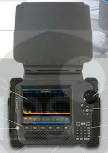
How Ground Radars Work
Ground penetrating radar (GPR) is a non-destructive geophysical method that produces a continuous cross-sectional profile or record of subsurface features, without drilling, probing, or digging. The ground penetrating radar (GPR) cross-section shows the ground surface at the top of the profile, and the reflections of subsurface geologic units and objects to a certain depth at the bottom. Ground penetrating radar surveys can be conducted using a GPR cart that is pushed along the ground surface, or they can be performed using an ATV or truck mounted configuration.
Lake and River Profilling
Groundradar has pioneered the use of GPR systems for lake and river sub-bottom profiling since 1992. With the advent of UltraGPR, enabling the entire radar system to be submerged or floated, rapid aerial mapping at low cost is possible. Groundradar often complements UltraGPR surveying with acoustic sub-bottom profilometers and fathometers. As is the case on land, fined-grained sub-bottom sediment can be highly attenuative to radar energy, whereas such clays and silts are ideal for acoustic profiling. Conversely, coarse-grained gravels and sands are ideal radar environments, but are unsuitable for acoustic methods. A combination of the two technologies can provide a complete model of the subsurface. Radar is only suitable in freshwater environments.
Coastal Profilling
Coastal ocean dynamics applications radar (CODAR) describes a type of portable, land-based, High Frequency (HF) radar developed between 1973 and 1983 at NOAA’s Wave Propagation Laboratory in Boulder, Colorado. CODAR is a noninvasive system that permits to measure and map near-surface ocean currents in coastal waters. It is transportable and offers output ocean current maps on site in near real time. Moreover, using CODAR it is possible to measure waves heights and it provides an indirect estimate of local wind direction.
Measuring surface currents is the primary result obtained by using CODAR. Ranges achieved and resolution vary with environmental conditions and antenna placement. In general, however, in their long-range mode, modern CODAR can measure out to 100–200 km offshore with a resolution of 3–12 km. By increasing the frequency, resolutions as fine as 200–500 m can be obtained, but the observation range is shortened (15–20 km). However, the actual range can be limited by radio interferences, high-ocean states and ground conditions in the vicinity of the antennas. Wet and moist sandy soils enhance the ground wave propagation, whereas dry and rocky grounds reduce signal strengths. A single CODAR system can measure only the component of surface current travelling toward or away from the radar so, to determine the total surface current vectors, it is necessary to use at least a two-system setup. An array of CODAR sites can be employed to obtain regional coverage. In a multiple radar configuration, spacing between two radar systems should be approximately 15 to 40 km for long-range open ocean mode and 8 to 20 km for “higher frequency, higher resolution, shorter range” mode. Typically, CODAR data are averaged over one hour to reduce the noisiness of the sea echo. Therefore, current maps can be produced every hour. This period can be reduced to approximately 20 minutes, however the data may become noisy over such a short period. CODAR’s measurements are interesting for both military and civil purposes. Main applications are for example coastal engineering and public safety projects, planning of navigational seaways, mitigation of ocean pollution, search and rescue operations, oil-spill mitigation in real time and larval population connectivity assessment. Also, data obtained by using CODAR are used as inputs for global resource monitoring and weather forecasting models and are particularly helpful for tidal and storm-surge measurements.[8] Moreover, from the measurements can be extracted the direction of propagation of wave energy and the period of the most energetic waves, which are important data for many practical applications in design and operation of coastal and offshore structures.